Each round of the quiz asks for the 50 states one by one, in a random order that changes every time. The prompt names a state, and the answer is a tap or click on that state on the map. There is no account, no timer and nothing to install. After the last question the round ends with the score and a list of the states that were missed.
The quiz covers the 50 states only. Washington, D.C. is not a state and does not come up. A version that asks for the capitals instead of the states is the states and capitals quiz.
How the US states map quiz works
The prompt at the top reads "Find" followed by a state name. The task is to locate that state and select it. The result is shown straight away: the state that was asked for turns green after a correct tap and red after a wrong one, and the score counter moves on. The states keep their color for the rest of the round, so the finished map is a record of what went right and what went wrong.
- Read the state name in the prompt.
- Tap or click that state on the map.
- See it turn green or red, with the score updated.
- Continue until all 50 states have been asked.
- Read the final score and the list of missed states, then press New round to start again with a fresh order.
The map can also be played from the keyboard. The Tab key moves from state to state, and Enter selects the one in focus. Each state has its name as an accessible label, so a screen reader announces it on focus.
Name all 50 states: where players slip
The hard states on a map are hard for map reasons. Rhode Island is the smallest state, with 1,545 square miles of total area including water, and Delaware, the second smallest, has 2,489. Both sit among their neighbors in the crowded Northeast, so a tap that lands a little off picks the wrong state. These are Census Bureau reference values from 2010.
Names cause a second kind of slip. Several states come in pairs that sound alike: the two Dakotas, the two Carolinas, and Virginia and West Virginia. The quiz asks for them one at a time and gives no hints.
Alaska is a special case. It is the largest state, with 665,384 square miles of total area, but on the map it is drawn at 0.35 of its scale and set into a box below the southwest, together with Hawaii. Anyone who expects Alaska to look big will find it smaller than its real proportions suggest.
The 50 states quiz on a phone
A phone screen is the hardest place to tap a small state, and the quiz is built to handle it. On a screen 390 pixels wide, ten states are too small to be hit reliably: Indiana, Massachusetts, New Jersey, Connecticut, Delaware, Maryland, New Hampshire, Tennessee, Vermont and Rhode Island. Indiana and Tennessee are not small by area but narrow, so their shortest side falls below the tap size the quiz aims for.
These states carry a marker. A tap near them zooms the map in by a factor of three, and once more if the target is still crowded, so the final tap lands on an enlarged state. After each answer the map goes back to the full view, and a Zoom out button is there for going back by hand.
In a test run on a 390-pixel screen, an answer took 1.52 taps on average, and never more than three. On a desktop screen the average was 1.08, which is close to one tap per state. The quiz runs in the browser and needs no installation.
Alaska and Hawaii in the quiz
Alaska and Hawaii are the two states that do not touch the other 48, and the map shows them in boxes under the southwest. They are ordinary targets in the quiz: a tap on the box selects the state, exactly as a tap on Texas would. Because the boxes are small, the same zoom that helps with the Northeast is available for them.
Hawaii was admitted as the 50th state on 21 August 1959, according to the National Archives, and it is the newest one. Its capital is Honolulu. The two boxes do not show true geography: Alaska is drawn at 0.35 of its scale, and the position of both under the southwest is a drawing convention, not a location.
A study plan around the quiz
A round of the quiz is a measurement as much as a game. The first round shows which states are already known and which are not. The list of missed states at the end is the study list, and it is worth writing down or copying before pressing New round, because the next round asks for all 50 states again in a fresh order and does not repeat only the misses.
- Play one full round and note the missed states.
- Look up those states on a labeled map, or print the blank map and write them in.
- Group them by region, using the table below, and study one region at a time.
- Play another round and compare the score and the list of misses with the first.
Repeating this a few times narrows the list. A printed blank map is a good companion, since writing a name into a shape asks for the same recall without the screen.
State names and initials
The names themselves have patterns. Four states begin with the word New, namely New Hampshire, New Jersey, New Mexico and New York. Five carry a compass word: North Carolina, North Dakota, South Carolina, South Dakota and West Virginia. The letters M and N start eight states each, A, I and W start four each, and seven letters of the alphabet start no state at all: B, E, J, Q, X, Y and Z.
None of this places a state on the map, but the groups help to keep names apart. The Carolinas and the Dakotas are neighbors in pairs, and the quiz asks for them separately, so knowing which of each pair lies to the north is the actual task.
Blank map of the US states for a quiz
A quiz does not have to stay on a screen. The printable map of the United States includes a blank map and a black-and-white outline, both on one Letter page in landscape format, which turn into a test as soon as they are printed. Students write the state names into the shapes and check the result against the quiz or a labeled map.
| File | Use | Download |
|---|---|---|
| Blank US map | Fill in the state names | PDF, SVG |
| Black-and-white outline | Printers, coloring | PDF, SVG |
| Numbered quiz sheet | Name the state behind each number | PDF, SVG |
| Answer key | Names for the numbers | PDF, SVG |
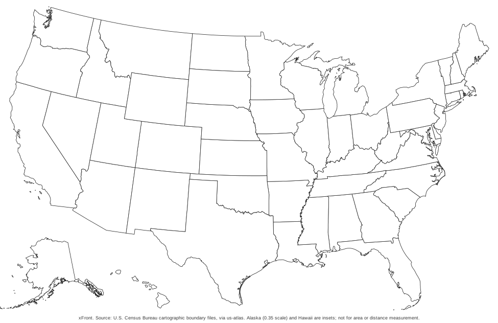
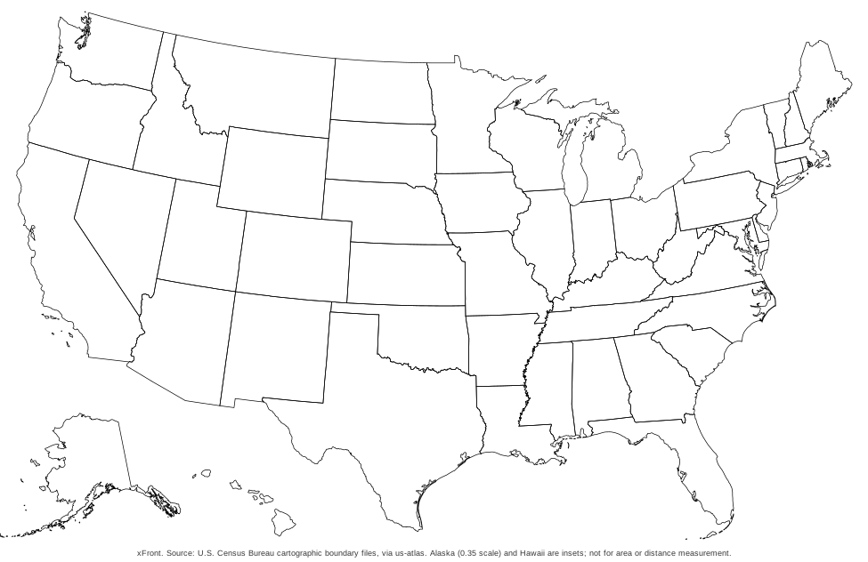
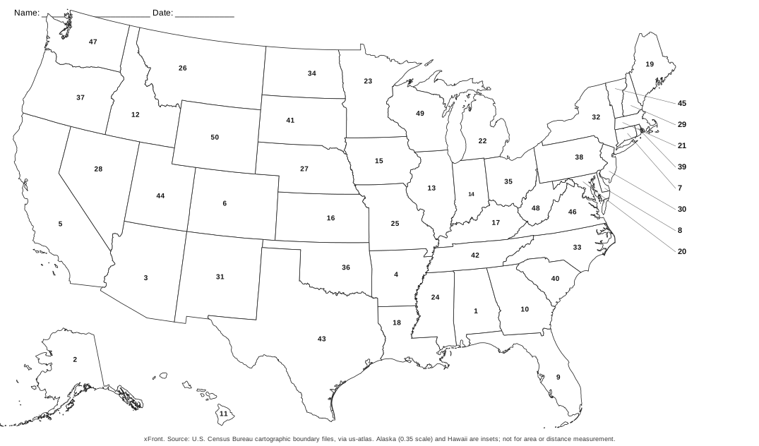
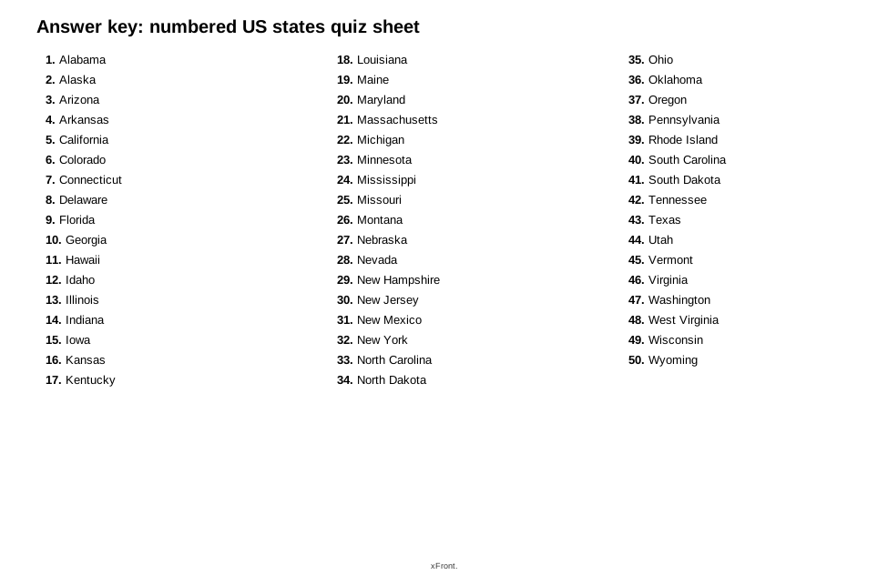
The numbered sheet puts a number from 1 to 50 on each state in alphabetical order of the state names, so Alabama is 1 and Wyoming is 50. The key lists the names in the same order. Every map carries a source line naming the U.S. Census Bureau.
US states quiz by region
The Census Bureau groups the 50 states into four regions: the Northeast with nine states, the Midwest with twelve, the South with sixteen and the West with thirteen. That adds up to 50. The District of Columbia is counted with the South by the Bureau, but it is not a state and is not among the 50.
The Bureau divides each region further. The Northeast consists of New England and the Middle Atlantic states, the Midwest of an East North Central and a West North Central division, and the South of the South Atlantic, East South Central and West South Central divisions. The West is split into eight Mountain states and five Pacific states. These smaller divisions give even tighter study sets than the regions.
The quiz asks for all 50 states in every round and has no round limited to a region. The table is for planning a study session around the same groups, one region at a time, before a full round.
| Region | States | Which states |
|---|---|---|
| Northeast | 9 | Connecticut, Maine, Massachusetts, New Hampshire, New Jersey, New York, Pennsylvania, Rhode Island, Vermont |
| Midwest | 12 | Illinois, Indiana, Iowa, Kansas, Michigan, Minnesota, Missouri, Nebraska, North Dakota, Ohio, South Dakota, Wisconsin |
| South | 16 | Alabama, Arkansas, Delaware, Florida, Georgia, Kentucky, Louisiana, Maryland, Mississippi, North Carolina, Oklahoma, South Carolina, Tennessee, Texas, Virginia, West Virginia |
| West | 13 | Alaska, Arizona, California, Colorado, Hawaii, Idaho, Montana, Nevada, New Mexico, Oregon, Utah, Washington, Wyoming |
Other sources draw the borders of regions such as the Midwest or the South a little differently. The table follows the Census definition.
US states quiz with capitals and abbreviations
This quiz asks for the state itself. To practice the capitals, the states and capitals quiz names a capital and asks for its state, on the same map and in the same way. The postal abbreviations are in the list of all 50 states below, next to the names, as the two-letter codes of the U.S. Postal Service.
All 50 states, with codes and regions
The list names every state the quiz asks about, in alphabetical order, with the postal code and the Census region.
| State | USPS | Region |
|---|---|---|
| Alabama | AL | South |
| Alaska | AK | West |
| Arizona | AZ | West |
| Arkansas | AR | South |
| California | CA | West |
| Colorado | CO | West |
| Connecticut | CT | Northeast |
| Delaware | DE | South |
| Florida | FL | South |
| Georgia | GA | South |
| Hawaii | HI | West |
| Idaho | ID | West |
| Illinois | IL | Midwest |
| Indiana | IN | Midwest |
| Iowa | IA | Midwest |
| Kansas | KS | Midwest |
| Kentucky | KY | South |
| Louisiana | LA | South |
| Maine | ME | Northeast |
| Maryland | MD | South |
| Massachusetts | MA | Northeast |
| Michigan | MI | Midwest |
| Minnesota | MN | Midwest |
| Mississippi | MS | South |
| Missouri | MO | Midwest |
| Montana | MT | West |
| Nebraska | NE | Midwest |
| Nevada | NV | West |
| New Hampshire | NH | Northeast |
| New Jersey | NJ | Northeast |
| New Mexico | NM | West |
| New York | NY | Northeast |
| North Carolina | NC | South |
| North Dakota | ND | Midwest |
| Ohio | OH | Midwest |
| Oklahoma | OK | South |
| Oregon | OR | West |
| Pennsylvania | PA | Northeast |
| Rhode Island | RI | Northeast |
| South Carolina | SC | South |
| South Dakota | SD | Midwest |
| Tennessee | TN | South |
| Texas | TX | South |
| Utah | UT | West |
| Vermont | VT | Northeast |
| Virginia | VA | South |
| Washington | WA | West |
| West Virginia | WV | South |
| Wisconsin | WI | Midwest |
| Wyoming | WY | West |
How the map was made: the outlines are the Cartographic Boundary Files of the U.S. Census Bureau, 2017 edition, redistributed by the us-atlas package and drawn with the d3 geoAlbersUsa projection, in which Alaska and Hawaii are insets and Alaska is drawn at 0.35 of its scale. A check confirmed that all 50 states are present and reachable in the quiz. The map is meant for finding states, not for measuring areas or distances.
Frequently asked questions
01How do I remember 50 states of the USA?
Take the states in groups instead of all at once. The four Census regions have 9, 12, 16 and 13 states, which makes each a manageable set. Print the blank map, write in what you know, check it against the quiz, and repeat only the states that were missed. A full round on the quiz shows which ones those are.