Which printable US map do you need?
The right map depends on what happens after printing. A teacher handing out a worksheet wants outlines with nothing on them. A student preparing for a test wants a blank map to fill in and a labeled one to check against. Someone looking up where a capital lies wants the map with capitals. The set covers each of those jobs with its own file, and every file shows the same 50 states in the same positions, so a blank sheet and its labeled counterpart line up exactly when held against a window.
The table lists what each variant contains and when it fits best. All of them come as a PDF for printing and an SVG for editing.
| Variant | Content | Best use | Formats |
|---|---|---|---|
| Blank | 50 states with white fill, no text | Worksheets, fill-in practice | PDF, SVG |
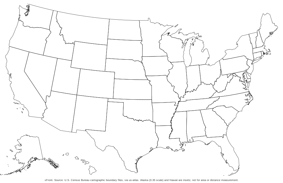
| Black-and-white outline | Outlines without fill | Printers and copiers, coloring | PDF, SVG |
| Postal abbreviations | Two-letter code on each state | Learning codes, addressing practice | PDF, SVG |
| State names | Full name on each state | Reference, answer sheet | PDF, SVG |
| Capitals | 50 capital points with names | Learning capitals, lookup | PDF, SVG |
| Quiz sheet and key | Numbers 1 to 50 and a name list | Tests, homework | PDF, SVG |
A few pairings make the choice quicker. For a first test of a class, the numbered quiz sheet and its key work as a pair. For a learner who is still at the stage of recognizing shapes, the blank map and the map with state names belong together, one to fill in and one to check. For a reader who needs the postal codes, for instance to address envelopes or read a shipping label, the abbreviations map is the one to keep on the desk. The black-and-white outline suits anyone who wants to color the states by hand.
Blank US map to print
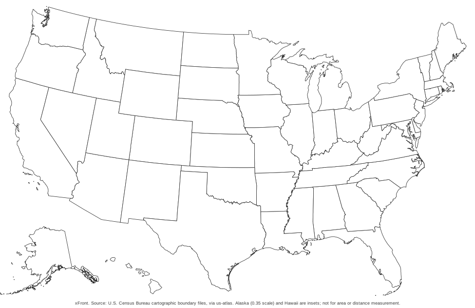
The blank map is the base for everything else in the set: 50 white states with thin gray borders and no text except a source line along the bottom edge. Alaska and Hawaii are part of the picture, drawn as insets under the southwest, so the sheet does not leave out the two states that do not touch the other 48.
A blank sheet is useful as a worksheet. Students write the state names or the abbreviations into the shapes, or color the map by region. It also serves as the base for a custom project, since each state is its own shape and can be colored one at a time.
Printing is simple: the PDF is a single landscape page in Letter size, so the printer dialog should be set to landscape and to scale the page to fit the paper. Pages printed this way keep the borders sharp and the margins even. For printers that struggle with large filled areas, the black-and-white outline variant has no fill at all and uses far less ink.
US map with state names and abbreviations
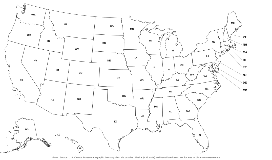
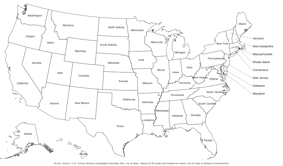
Two labeled variants cover the same ground in different ways. The version with postal abbreviations prints the two-letter code on each state, such as AL for Alabama and WY for Wyoming. The codes follow the list in USPS Publication 28, Appendix B. The version with full names prints each state name instead, which makes it the better choice for an answer sheet that a student can read without decoding anything.
The Northeast is the hard part of any US map at this size. Vermont, New Hampshire, Massachusetts, Rhode Island, Connecticut, New Jersey, Delaware and Maryland are too small for a label inside their own borders. In both labeled variants these states are named in a column at the right edge of the sheet, each with a thin line running back to the state it belongs to. Maine has its label placed beside it.
The District of Columbia is not drawn on any of the maps, since it is not a state. A reader who needs the district will find it covered with the other federal and territorial entries in the list of all 50 states and capitals.
US map with capitals to print
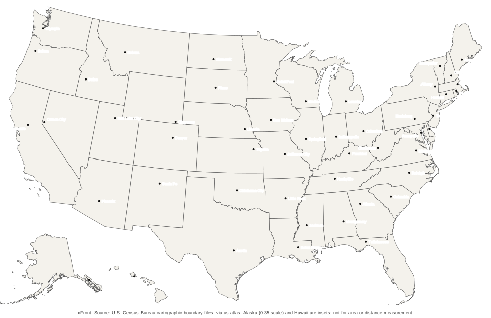
The capitals variant marks the capital of every state with a point and prints the city name next to it. Fifty points and fifty names make up the labeling; the state names are left off so that the map stays readable and doubles as a test: a student can name the state first, then check the capital.
Larger cities that are not capitals do not appear. A reader who needs Los Angeles or Chicago on the sheet will not find them here, and the map does not pretend otherwise. The capital positions come from the same dataset as the table of states, and a position check confirmed that all 50 points fall inside the correct state.
For an on-screen version where each state can be selected, see the US map with capitals. The same capitals work as a quiz on the states and capitals quiz, where each capital is asked for by name and answered by tapping the state.
Numbered quiz sheet and answer key
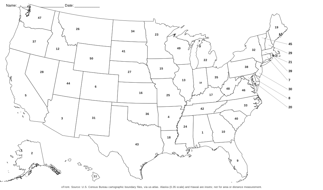
The quiz sheet puts a number from 1 to 50 on every state. The numbers follow alphabetical order of the state names, so Alabama is 1, Alaska is 2 and Wyoming is 50. A name and date line runs along the top of the page. As on the other labeled maps, the small states of the east coast carry their numbers in a column at the right edge, joined to the states by short lines.
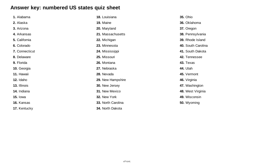
The answer key is a separate page with the 50 numbers and names in a list. Print it on its own, keep it apart from the sheet, and mark the test by comparing the two. A full test is 50 answers, but nothing stops a teacher from asking only for a region, such as the numbers that belong to the nine Northeast states.
Both files use the same alphabetical numbering, so a sheet and a key always agree. Delaware is 8, Maryland is 20 and Vermont is 45 on both.
Coloring the map by region
The Census regions give a ready scheme for coloring a blank or outline map: Northeast, Midwest, South and West, with 9, 12, 16 and 13 states. Of the eight states that need leader lines on the labeled maps, six lie in the Northeast, namely Vermont, New Hampshire, Massachusetts, Rhode Island, Connecticut and New Jersey. Delaware and Maryland belong to the South.
Coloring a region before learning its states gives the eye something to hold on to. The shapes of the Mountain states in the West, the long Atlantic side of the South and the compact group of New England states each become one block. Because every state in the SVG is a separate shape, the same scheme can be applied on screen in a vector program, with one fill per region.
How can you memorize the US states on a map?
Fifty shapes are too many to learn in one pass, so the work is easier in parts. The Census Bureau splits the states into four regions: the Northeast with nine states, the Midwest with twelve, the South with sixteen and the West with thirteen. One region per session gives a manageable target. The loop below uses the maps in the set and needs only a pencil.
- Pick one region and print the labeled map.
- Study the states of that region for a few minutes, noting neighbors and shapes.
- Print the blank map and write in every state of the region from memory.
- Compare with the labeled map and mark the misses.
- Repeat only the missed states, then add the next region.
The numbered quiz sheet suits the final stage. Every state carries a number from 1 to 50 in alphabetical order, so Delaware is 8 and Maryland is 20, and the answer key lists the names in the same order. The test can be taken on paper and marked in a minute. No claim is made here about how well any method works, only about what the files offer. A screen version of the same exercise, with random order and a score, is the US states quiz.
PDF or SVG: which file should you download?
The PDF is the print file. It is one landscape page in Letter size, 11 by 8.5 inches, and it opens in any PDF viewer without further setup. Choose it whenever the goal is a sheet of paper.
The SVG is a vector drawing. It scales to any size without losing sharpness, opens in a browser, and can be edited in vector programs. Each of the 50 states is a separate shape named by its postal code, so one state can be recolored without touching the others. The shapes are identical to those in the PDF.
| Need | File | Why |
|---|---|---|
| A page for the classroom | Ready to print on Letter paper | |
| A poster or large print | SVG | Stays sharp at any size |
| Colored regions, custom labels | SVG | Each state is a separate shape |
| Placing the map in a document | SVG | Vector graphics scale inside layouts |
File sizes are printed beside each download button. The map SVGs are roughly 160 KB each, and the PDFs range from about 60 to 200 KB.
Printing tips for the PDF maps
Letter landscape is the format of all PDFs. On A4 paper the same file prints without trouble when the dialog is set to fit the page, which shrinks it slightly. Setting the printer to actual size instead can cut off the edges.
Color printers show the capitals map with a light warm gray fill. Black-and-white printers are better served by the outline variant. The quiz sheet prints with a name and date line at the top, ready for a class.
A test print on plain paper is worth the minute it takes. The small labels in the Northeast are the smallest text on any sheet, and a quick look shows whether the printer scaled the page properly before a whole class set is run.
Alaska, Hawaii and the District of Columbia
The maps use a projection that draws the 48 contiguous states in one frame and sets Alaska and Hawaii in boxes below the southwest. Alaska is shown at 0.35 of the scale used for the other states. It is the largest state by far, with 665,384 square miles of total area against 1,545 for Rhode Island, but on these sheets it looks about as big as a mid-sized state.
That has a consequence for use. The maps are made for recognizing states and learning names, not for comparing sizes or measuring distances, and each sheet says so in its source line. The District of Columbia is left out because it is not a state.
Where does the map data come from?
The outlines come from the Cartographic Boundary Files of the U.S. Census Bureau, 2017 edition. These are simplified boundaries made for small-scale thematic maps. They reached the site through us-atlas, a package that redistributes the Census files as TopoJSON, and were drawn with the d3 geoAlbersUsa projection for a frame of 975 by 610 units. That projection is a composite: it treats the 48 contiguous states with an Albers conic projection and places Alaska and Hawaii as insets.
The capital points come from the dataset behind the states and capitals list. All 50 were tested against the state outlines and sit in the correct state. The points are reference positions for a map of this size, and the origin of the coordinates is not documented, so they should not be used for surveying.
How can the maps be used?
The maps are free to download and print. Every file carries a source line naming the U.S. Census Bureau, and the Bureau's own metadata for the boundary files states that they are free to use in a product or publication as long as the Census Bureau is acknowledged as the source. The same metadata describes them as suitable for display at small scales and not for calculating areas or perimeters, and the maps should not be used to compute areas, perimeters or addresses.
Beyond printing for personal or classroom use, this page makes no promises about reuse. The Census Bureau's terms for its boundary files are the reference for anyone planning to publish the maps in a product.
Frequently asked questions
01Can I get a map of the United States of America?
Yes. The downloads cover the 50 states in six variants, each as a PDF and an SVG: blank, black-and-white outline, with postal abbreviations, with state names, with capitals and as a numbered quiz sheet. The quiz sheet has a separate answer key. Every PDF is one landscape page in Letter size.
02How to memorize the US states on a map?
Split the 50 states into the four Census regions of 9, 12, 16 and 13 states and work through one region at a time. Fill in the blank or numbered map from memory, check it against the labeled version, and repeat only the states that were wrong. The tap-to-answer quiz offers the same loop on a screen.
03Is there a blank US map quiz?
Two versions exist. The numbered quiz sheet prints with every state carrying a number from 1 to 50, and the answer key lists the names. For a quiz on screen, the US states quiz asks for each state in random order and counts the correct taps.
04Is there a printable US map with state names?
Yes. One variant prints every state name, and another prints the two-letter postal abbreviations instead, which stay legible in the crowded Northeast. In both, the small states along the east coast are labeled in a column at the right edge with lines running back to the state.
05Is there a printable US map with cities?
The map with capitals marks and names all 50 state capitals. Larger cities that are not capitals are not on the maps yet, so a map with major cities is not part of the set.